


Darlove Baptist Church Voting District, Washington County, Mississippi
About
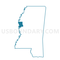
Outline

Summary
| Unique Area Identifier | 606892 |
| Name | Darlove Baptist Church Voting District |
| County | Washington County |
| State | Mississippi |
| Area (square miles) | 56.72 |
| Land Area (square miles) | 55.91 |
| Water Area (square miles) | 0.82 |
| % of Land Area | 98.56 |
| % of Water Area | 1.44 |
| Latitude of the Internal Point | 33.27900710 |
| Longtitude of the Internal Point | -90.78475220 |
Maps


Graphs
Select a template below for downloading or customizing gragh for Darlove Baptist Church Voting District, Washington County, Mississippi


Neighbors
Neighoring Voting District (by Name) Neighboring Voting District on the Map
- Arcola City Hall Voting District, Washington County, MS
- Gooden Lake Voting District, Humphreys County, MS
- Grace Methodist Church Voting District, Washington County, MS
- Hollandale City Hall Voting District, Washington County, MS
- Indianola 2 West Voting District, Sunflower County, MS
- Isola Voting District, Humphreys County, MS
- Leland Health Dpt. Clinic Voting District, Washington County, MS
Top 10 Neighboring County Subdivision (by Population) Neighboring County Subdivision on the Map
- District 2, Washington County, MS (11,758)
- District 4, Washington County, MS (9,787)
- District 5, Washington County, MS (9,476)
- District 2, Sunflower County, MS (5,147)
- District 2, Humphreys County, MS (1,903)
Top 10 Neighboring Unified School District (by Population) Neighboring Unified School District on the Map
- Indianola School District, MS (11,488)
- Sunflower County School District, MS (10,540)
- Humphreys County School District, MS (9,375)
- Leland School District, MS (6,009)
- Hollandale School District, MS (3,750)
Top 10 Neighboring State Legislative District Lower Chamber (by Population) Neighboring State Legislative District Lower Chamber on the Map
- State House District 34, MS (21,017)
- State House District 28, MS (20,377)
- State House District 50, MS (20,010)
- State House District 31, MS (19,331)
- State House District 51, MS (19,142)
Top 10 Neighboring State Legislative District Upper Chamber (by Population) Neighboring State Legislative District Upper Chamber on the Map
- State Senate District 22, MS (48,806)
- State Senate District 13, MS (46,404)
- State Senate District 12, MS (43,572)
Top 10 Neighboring 111th Congressional District (by Population) Neighboring 111th Congressional District on the Map
Top 10 Neighboring Census Tract (by Population) Neighboring Census Tract on the Map
- Census Tract 15, Washington County, MS (4,319)
- Census Tract 17, Washington County, MS (2,646)
- Census Tract 9502, Humphreys County, MS (2,574)
- Census Tract 9506, Sunflower County, MS (2,571)
- Census Tract 1, Washington County, MS (1,648)